Start with a Free Quote Today
- Home
- The Woodlands, TX
The Woodlands, TX
Residential neighborhoods built across multiple development phases sometimes face boundary questions when original survey markers become obscured by landscaping or construction. Spring and summer months bring heavy rainfall that affects ground conditions and highlights the importance of accurate elevation data for flood insurance and FEMA compliance.
A land survey establishes exact property boundaries and identifies easements, encroachments, or other features that affect ownership rights. This service proves essential before purchasing property, building fences, adding structures, or resolving neighbor disputes. You receive a detailed map showing property lines, improvements, and any recorded restrictions.
Topographic surveys map the elevation changes and physical features across your land. Engineers, architects, and developers rely on this data when planning site drainage, building placement, parking lots, and utility installation. In The Woodlands, where natural terrain varies and stormwater management follows strict guidelines, topographic information helps ensure projects meet both municipal requirements and environmental standards.
Elevation certificates document your building’s height relative to base flood elevation. Mortgage lenders and insurance companies often require this certificate to determine flood risk and set insurance rates. Properties in designated flood zones need current elevation data to qualify for certain coverage options or to appeal flood zone determinations. We measure and certify building elevations following FEMA standards, providing documentation you can submit directly to insurance providers.
Replat services become necessary when subdividing land, combining parcels, or adjusting lot lines. The Woodlands continues seeing property modifications as commercial spaces expand and residential lots undergo reconfiguration. A replat updates official records to reflect new boundaries and ensures your property description matches current conditions. This process requires surveying work, document preparation, and coordination with local planning departments.
Our surveying process begins with research into existing records, deed descriptions, and previous survey data. We then conduct fieldwork using GPS technology and traditional surveying instruments to capture precise measurements. Clay soils common in this region can cause ground movement between seasons, so we account for these conditions when establishing permanent boundary markers.
Tree coverage throughout The Woodlands neighborhoods sometimes limits GPS satellite visibility, requiring alternative measurement techniques to maintain accuracy. We adapt our methods to site conditions while ensuring all work meets Texas Board of Professional Land Surveying standards.
After completing fieldwork, we prepare detailed drawings and legal descriptions documenting our findings. You receive clear maps showing boundaries, elevations, or topographic features depending on your service type. All documentation includes our professional seal and signature, providing the official certification required for permits, closings, or insurance submissions.
Commercial projects often need multiple survey types. A new retail development might require boundary surveys to confirm property limits, topographic surveys for site planning, and elevation certificates for individual buildings. We coordinate these services to support project timelines and help you avoid delays caused by incomplete documentation.
Residential customers frequently need surveys when refinancing, selling property, or planning additions. A current survey protects your investment by confirming you build within your property lines and meet setback requirements. This prevents costly mistakes that could require structure removal or legal action.
The Woodlands operates under specific planning standards that affect survey requirements. Village associations and architectural review boards may request survey information as part of approval processes. Understanding these local requirements helps us deliver documentation that satisfies both municipal authorities and community standards.
Timing matters for surveying projects. Spring vegetation growth can obscure ground features and boundary markers, sometimes extending fieldwork duration. Planning your survey during fall or winter months may allow faster completion, though we maintain service availability year-round to meet urgent project needs.
Flood zone changes periodically affect properties throughout Montgomery County. When FEMA updates flood maps, your property designation might shift, potentially increasing insurance costs. An elevation certificate can document your building’s actual flood risk, sometimes leading to lower premiums or zone reclassification.
We maintain professional liability insurance and follow continuing education requirements to stay current with surveying technology and regulatory changes. Our work provides the reliable data you need whether you are buying your first home, developing a commercial center, or managing an existing property portfolio.
Questions about property boundaries, elevation requirements, or survey timing are common. Visit our FAQs page for answers to frequently asked questions, or explore our services page for detailed information about each survey type we offer.
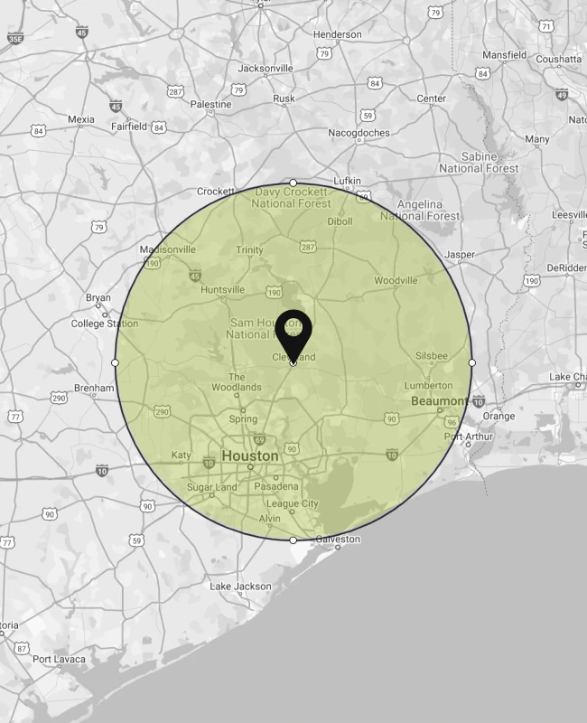
Ready to move forward with your project? Contact us at (936) 513-7940 or email orders@tcsurveyandmapping.com. We are available Monday through Friday, 9 AM to 5 PM, to discuss your surveying needs and provide project estimates. Our team serves The Woodlands and surrounding areas with accurate, timely surveying solutions that support your property goals.